Endangered Species
Identifies the threatened species in the project.
Guidelines for Phenology Photography
Defines the approach to photography for the purpose of documenting the trees
About the Project
Defines roles, responsibilities and identification guidelines
Trees of Puerto Rico and the Virgin Islands
This is a very large (34.4MB) document, written in 1964 for the U.S. DEPARTMENT OF AGRICULTURE
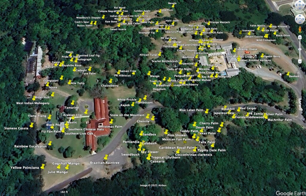
Google Earth KMZ file
You can view the location of the trees in Google Earth on your phone, tablet, or computer. Click the link above and save the downloaded file. Please note that the GPS location was obtained by photographing the plant label on my phone and extracting the file info using Photoshop. The accuracy of the GPS on a phone is limited to a radius of about 15 feet, depending on conditions.
- Android
When download completes, click “open” and Google Earth will open the file. - iPhone & Computer
When download completes, click Save and save to Files or Downloads. Open Google Earth in your browser, start a new project and select the phenology.kmz file from your Files directory. (You only need to do this for the first time of viewing)

